The Sandy Ranch West
Our Private 'Enchanted Rock' in Fredericksburg, Texas
PROPERTY MAP
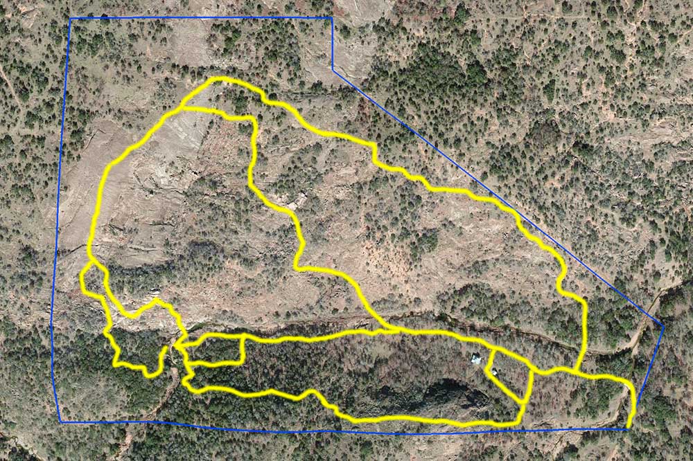
Below is a satellite view of the ranch. The blue line denotes the property boundaries. The yellow lines indicate marked trails and roads.
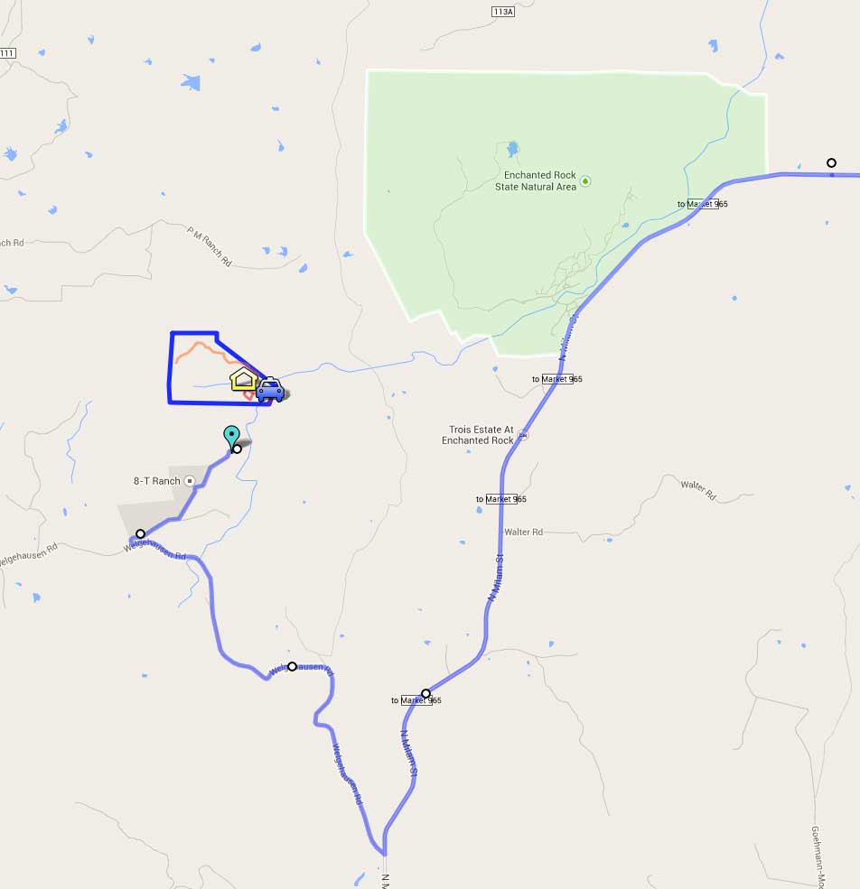
Here you can see its location relative to Enchanted Rock. The property line is only about 0.8 miles from the state park's boundary.