|
|
|
|
|
|
|
|
||||||||||||||||||||||||||||||||||||||||||||||


CHALK RIDGE FALLS PARK

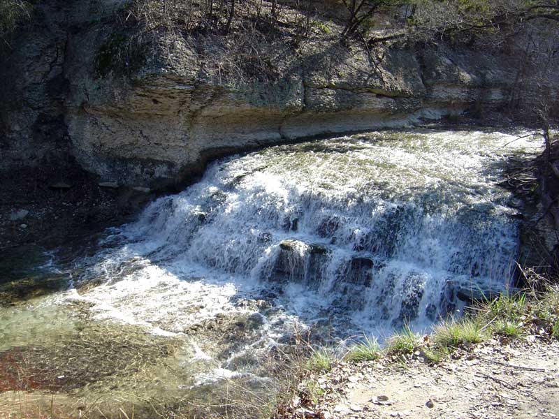
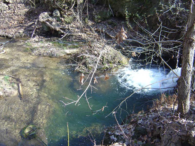
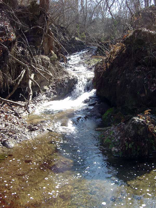
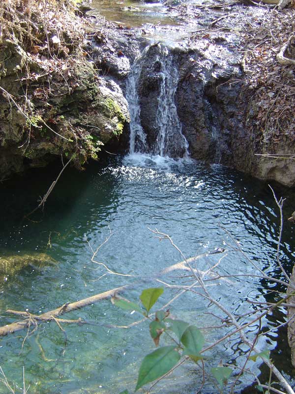
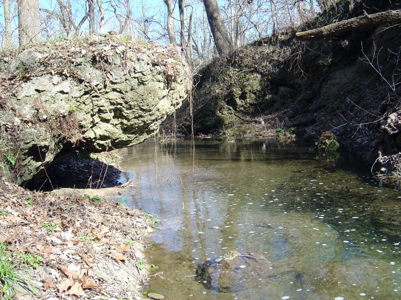
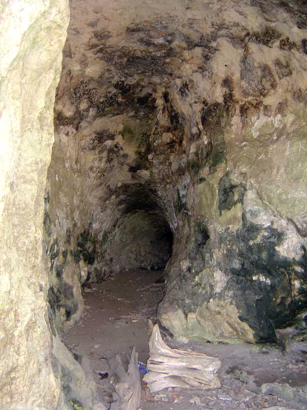
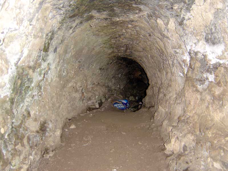
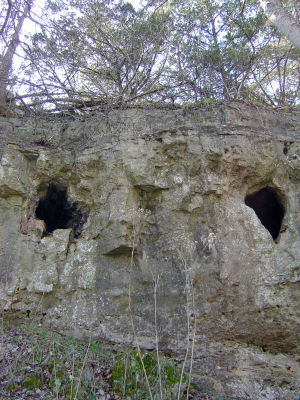
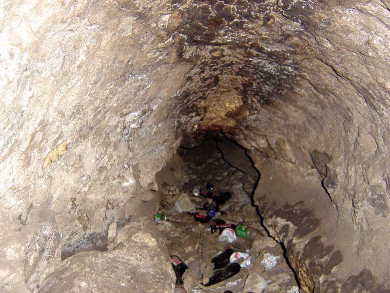
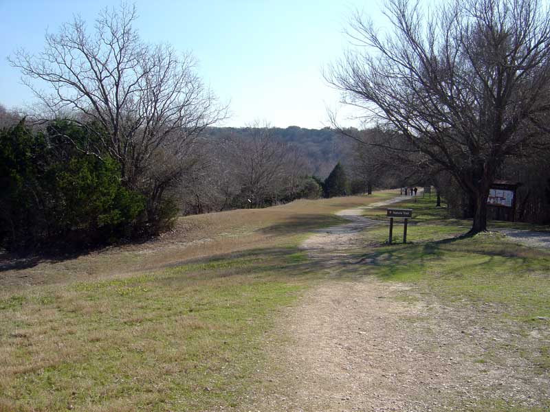
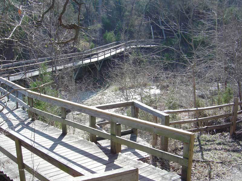
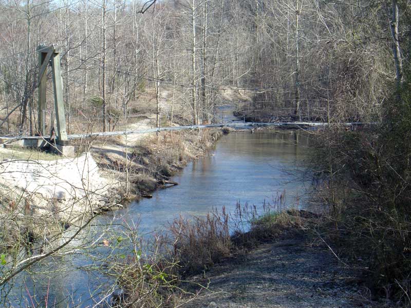
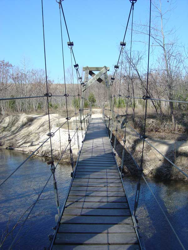
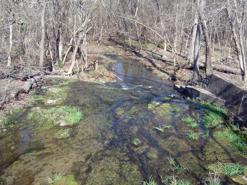
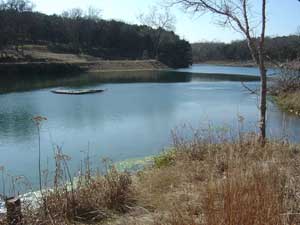
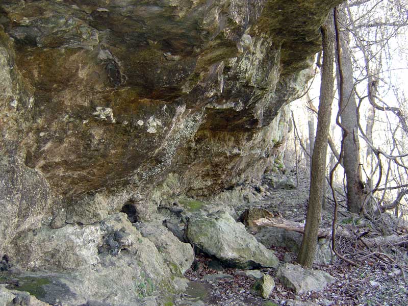
ABOUT THE PARKIt isn't often that I can recommend a place that's north of Austin, but this is an exception. Chalk Ridge Falls Park is just north of Salado - about a 35 minute drive out of Austin. It's next to Stillhouse Hollow Lake. This hiking trail is great because of the variety. It starts off on a nicely maintained path with railings, bridges, info signs, etc. But as you go farther the trail turns into a dirt path which can get quite rugged and overgrown somtimes. Unfortunately, the floods in 2007 took out the really neat suspension bridge, and as of November 2007 they still had not fixed it, and the trail was closed at that point. However... In addition to the obvious trail that follow the river for about 2 miles, you can also make your own trail by following the creek that the walkway crosses (by the green pond). So, when you walk down the nicely maintainted trail you'll get to a wooden bridge/walkway that crosses a creek. There are some steps there that will take you down to the creek bed. If the water level is right, you can walk that creek bed for about a mile upstream. This is the best part of the park! The creek has cut deep into the limestone there, so it has made a really neat canyon that has caves and springs all over the place. The farther you go upstream, the more interesting it gets. You'll see water gushing from large springs in the side of the cliff wall. On the main trail there are a series of falls - at the beginning of the trail and at the end by Camp Tahuaya. The falls at the beginning are impressive, but the best ones are those at the end in my opinion, so it's really worth the hike to see them. The entire trail parallels the Lampassas River, and it's a pretty basic, flat trail. The interesting thing about it, however, is the large number of very large fallen trees. There are huge trees bent in half all over the place (see photo below). Another good reason to hike the full length of this trail is to see the cave. There's a cave near the last section of the trail which you can easily miss if you're not looking for it. The cave is not immeditately off the trail, but it's carved into the bluff that's up the hill on your right. You have to scramble up a steep hillside to get to the cave, but it's worth seeing, and there's some exploring to do up at the bluff. Unfortunately, the cave is loaded with beer bottles and litter (as shown in the photos below), and I don't know how far the cave goes in. I went in about 25 feet which was as far as I could go without a flashlight. It appeared that the tunnel kept going though. If you have a GPS unit, here are the coordinates for the cave entrance: N 31º 00.885' W 097º 30.544' Just past the cave is where the best set of falls are, and then if you follow the trail up the falls you'll get to the boyscout camp with a small lake there. That's the end of the trail, and remember, you're on private property. HOW TO GET THERETake 35 North past Salado. Exit at FM 2484 and turn left following the signs to Chalk Ridge Falls Park / Stillhouse Hollow Lake
PICTURES |
|
Falls & Ponds
 |
 |
|||||
 |
 |
 |
||||
 |
||||||
Caves
 |
 |
 |
||
 |
||||
 |
||||
Misc Photos
 |
 |
||
 |
 |
||
 |
|||
 |
 |
||
 |
 |
||
©2005 Pangea Software, Inc.
|
|
|
|
|
|
|
|
||||||||||||||||||||||||||||||
©2001-2011 Brian Greenstone